Publisher description
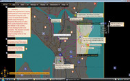
Depiction is a new type of mapping and simulation software that brings an easy, affordable \"what-if\" experience to everyday folks. Select a geographic area, then download or import data images, or even live reports. Your data immediately becomes interactive, influencing the behavior of other elements. Import spreadsheets, GIS shape files, elevation data from DEM files, and digital images. Make your map elements interact: for example, place a road barrier to reroute an evacuation, or hold back water by making a levee with a water barrier. Depiction is being used by emergency managers, educators, consultants, GIS professionals and everyday people to build dynamic, interactive maps and simulations.
Related Programs

Excel Sheet Navigation & Management Software 1.1
Switch, search & copy worksheets quickly.
MaterialWorlds Simulations 1.5
Play and experiment with virtual reality sims
ESRI Shapefile Plug-In for GIS.NET 2.0
High-Performance ESRI Plug-In for GIS.NET
Maps download 1.01
Store Google, Yahoo, VE maps to local disk
Google Maps Grabber 1.0.7
Explore and capture google maps.